Welcome KGeoTag!
February 27, 2021
Just a quick shout-out to Tobias who just released version 1.0.0 of KGeoTag. As you can probably guess from the version number, KGeoTag is quite a young project - though it already has some nice features.
What is KGeoTag?
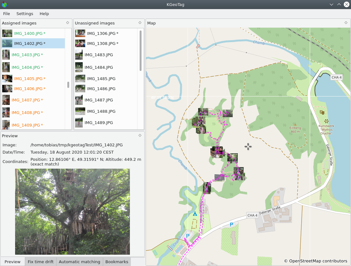
You can use KGeoTag to assign image files to GPS locations. This can help you with remembering the exact location where a photo was taken, or with discovering images that were taken at the same place. Of course, this is most useful when used together with another program such as KPhotoAlbum, that can adequately display this information and lets you search by GPS coordinates ;-)
What can it do?
With KGeoTag, you can:
- Match image coordinates to GPX track files based on time information
- Drag and drop images to points on the map
- Store bookmarks for frequently used places
- Set the elevation (manually or by looking it up online)
The app shows assigned and unassigned images in different lists so that the current status is immediately obvious (showing all images in one list is also possible).
I find that it provides a nice workflow especially when there are “holes” in a GPX track where images can not be matched to a GPS datum with reasonable accuracy. In these cases I first load the images and the GPX track and let KGeoTag auto-assign most images. The remaining images can then be assigned manually and when I’m content with the outcome I save the coordinates into the image metadata.
If you are interested, check out the README.md file that comes with KGeoTag for more details.